The appeal
Route 66 travellers are drawn to ruins: old gas stations, empty motels, collapsed cabins, weathered signs, ghost towns and desert structures half-returned to dust. There is a romance to them, but there is also a responsibility. These places are not props placed for our cameras. They are the remains of economic shifts, bypasses, family businesses, drought, migration, tourism booms, tourism collapses and the brutal efficiency of the interstate system.
What ruins teach
A ruin can explain Route 66 faster than a paragraph. Stand in front of an abandoned service station beside a road that no longer carries much traffic, and you understand what decommissioning meant at ground level. The road did not simply become historic. Some businesses lost their lifeline. Some towns adapted. Some did not. The ruins are the physical memory of that transition.
Ghost towns versus living towns
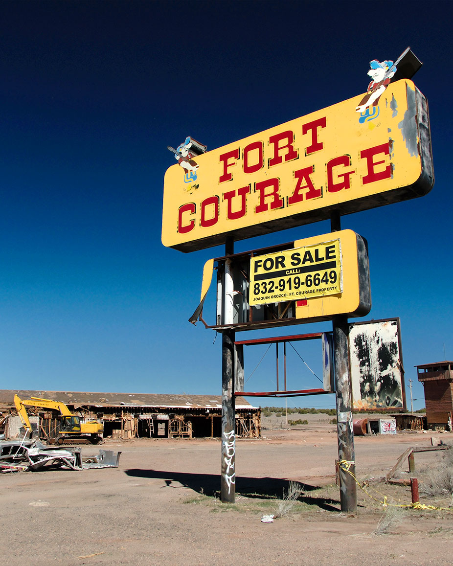
Be precise with language. Some places called ghost towns still have residents nearby, private property, active businesses or cultural significance. Others are true remnants. The traveller’s job is to look carefully and behave respectfully. Do not turn someone’s struggling town into an aesthetic. Do not treat abandonment as entertainment without acknowledging why it happened.
Route 66 ghost towns, ruins and abandoned places to look for
The term “ghost town” gets used loosely on Route 66. Some places are genuinely abandoned, while others still have residents, operating businesses or private property among the ruins. The most interesting stops are often somewhere in between.
Glenrio, Texas and New Mexico
Straddling the state line, Glenrio is one of the clearest examples of what an interstate bypass could do to a Route 66 community. Once filled with motels, diners and gas stations, the town declined after Interstate 40 bypassed it in 1975. Today its historic district preserves the old roadbed and a remarkable collection of former roadside buildings, including motel, diner and service-station remains.
Texola, Oklahoma
At the western edge of Oklahoma, Texola is a tiny community where surviving Route 66 structures hint at a much busier past. One of the most important is the former Magnolia Service Station, built around 1930 as paving reached this section of the Mother Road. Places like Texola are worth approaching as communities with history rather than abandoned film sets.
Cuervo and the old road west of town, New Mexico
Around Cuervo, you can see both the remains of roadside settlement and an abandoned section of Route 66 itself. West of the community, an old 1932 alignment runs away from the interstate through open rangeland, with surviving culverts, road cuts and traces of pavement. Some sections are extremely rough, so road conditions matter more here than nostalgia.
Painted Desert Trading Post, Arizona
Standing alone beside an abandoned Route 66 alignment, the Painted Desert Trading Post became one of the road’s most evocative ruins after closing in the early 1960s. Preservationists later purchased and stabilised the threatened building rather than rebuilding it into something new. Access crosses privately managed land, so this is a place to check current access arrangements before visiting rather than simply following an online pin.
Two Guns, Arizona
Two Guns grew into a roadside attraction around the dramatic Canyon Diablo landscape, with tourist facilities developing around the highway during the Route 66 era. Ruins remain around the area today, alongside the historic Canyon Diablo Bridge. As with many abandoned Route 66 sites, ownership, access and safety need to be checked before exploring beyond public roads.
Amboy, California
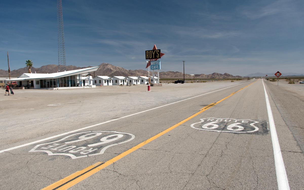
Amboy shows that “ghost town” does not necessarily mean completely abandoned. The Mojave Desert settlement lost much of its traffic after Interstate 40 bypassed the old highway, but Roy’s Motel and Café remains its unmistakable landmark. Fuel and limited services have returned, and preservation work continues, making Amboy a useful example of a place that declined dramatically without disappearing entirely.
These stops are compelling because they show different stages of survival. Glenrio preserves the remains of an entire roadside economy. Amboy is slowly being revived. Elsewhere, an abandoned roadbed or empty service station may be all that remains.
Visit them for what they can teach you, not simply because they look abandoned. Stay on public roads, respect fences and private property, check current access conditions and never assume that an empty-looking building is safe or ownerless.
The Mojave
The California desert gives some of the most dramatic ruin experiences on Route 66. Long distances, heat, dry air and changing transport patterns created a landscape where old stations and settlements can feel suspended in time. The desert makes everything look cinematic, but it is also harsh. Carry water, watch your fuel, and do not wander into unsafe structures.
Old gas stations
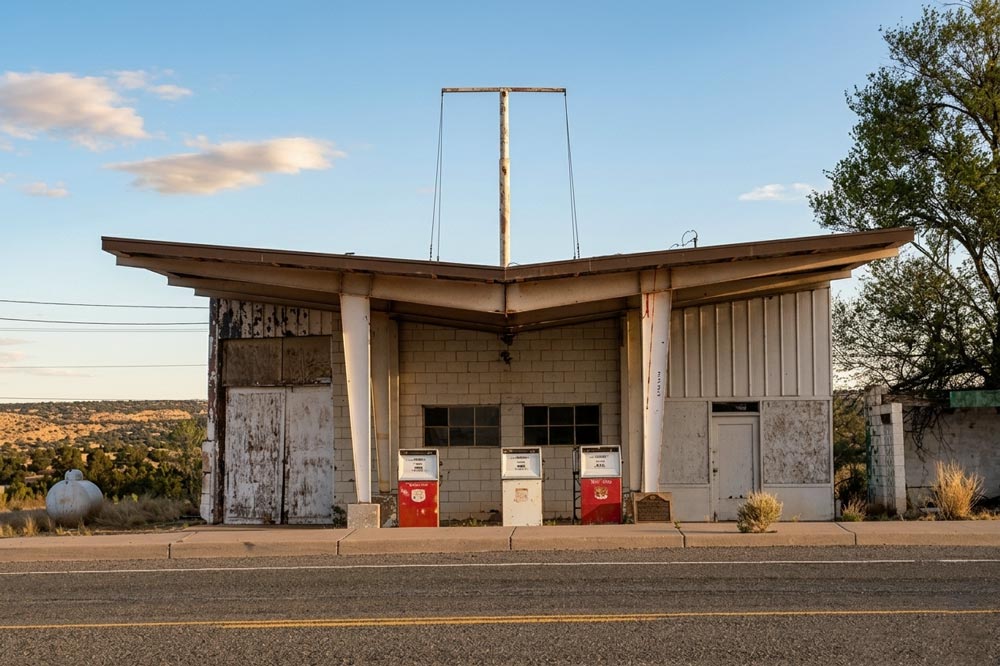
Gas stations are among the most powerful abandoned Route 66 sites because they represent the road’s basic need: movement. Their canopies, pumps, service bays and signs were built around cars, travellers and commerce. When they close, they leave behind a shape that still tells you what used to happen there. You can almost hear the bell hose, the tools, the screen door, the owner stepping out to ask where you are headed.
Ethics of photographing ruins
Take photos from public areas unless permission is clear. Avoid climbing, moving objects, entering unstable buildings or posting directions to fragile sites that cannot handle traffic. If a place is being restored, support it. If a nearby business is open, buy something. A road trip economy survives through small transactions, not only admiration. If you are planning a detour to a remote stop, check its latest known status before committing the time and distance.
A different kind of beauty
Ruins are beautiful because they are honest. They show that Route 66 is not only burgers, neon and cheerful nostalgia. It is also loss, reinvention and time. That makes the joyful places more meaningful. A restored motel sign glows brighter when you have seen how many signs went dark.
Abandoned places are not empty stories
Ruins on Route 66 often look romantic, but many are evidence of a brutal economic shift. When interstates bypassed towns, traffic could disappear almost overnight. A cafe built for passing motorists could not survive if the stream of cars moved to a faster road several miles away. The National Park Service notes that the 1984 bypassing of the last U.S. 66 section by I-40 led to the 1985 decommissioning, and that process affected countless roadside businesses and communities.
That is why abandoned service stations, motel shells and cracked forecourts should be handled carefully in writing and photography. They are beautiful because time has made them graphic, but they are also the remains of people's work. Some were family businesses. Some closed because the owner aged out. Some lost traffic. Some were simply outcompeted by chains and interstates.
A better way to visit ruins
Use the ruins category as a way to tell the road's second story: not just boom, but bypass. Look for old pumps, canopy shapes, room-number plates, cafe windows, domestic details and hand-painted signs. Stay outside fences. Do not remove objects. If a place is unsafe or private, photograph from public space and log what you can verify rather than inventing a dramatic backstory.
The most interesting ghost towns and abandoned stretches often sit where transport routes changed more than once: railroad, wagon road, National Old Trails Road, Route 66, then interstate. Route 66 did not create every town, and the interstate did not kill every town, but the road often amplified both life and decline.
Take it with you in Route 66 Logbook
Use Route 66 Logbook to record what a ruin or abandoned stop actually was, not just how it looks today. Check the stop details before you detour, stay on public ground, and add one line about its history and one about what you noticed there.
Ask what the ruin can teach you
Abandoned places can make travellers feel like they have found something untouched, but most have been photographed, mapped and discussed for years. The more useful question is not 'Am I the first?' but 'What am I learning by being here?' That question keeps the experience respectful.
Safety comes before the photograph
The safest ruins are often the ones you can appreciate from the road. A collapsed roof, broken glass, unstable flooring or hidden debris can turn curiosity into injury. No photograph is worth entering a structure that clearly does not want people inside it anymore.
Support what is still open
When a ruin sits near a living business, spend time with the living business too. The old place shows what was lost; the current place shows what is still possible. Route 66 needs both memory and commerce to survive.


